About
Who We Are
We're neighbors from Lake City and across Seattle coming together after losing local grocery and pharmacy access. These changes have made daily life harder for many of us. We're organizing to bring back what our community needs most: nearby, reliable places to get food, medicine, and care. Together, we're pushing for solutions that keep Lake City connected and thriving.
Contact us: restorelakecityaccess@gmail.com
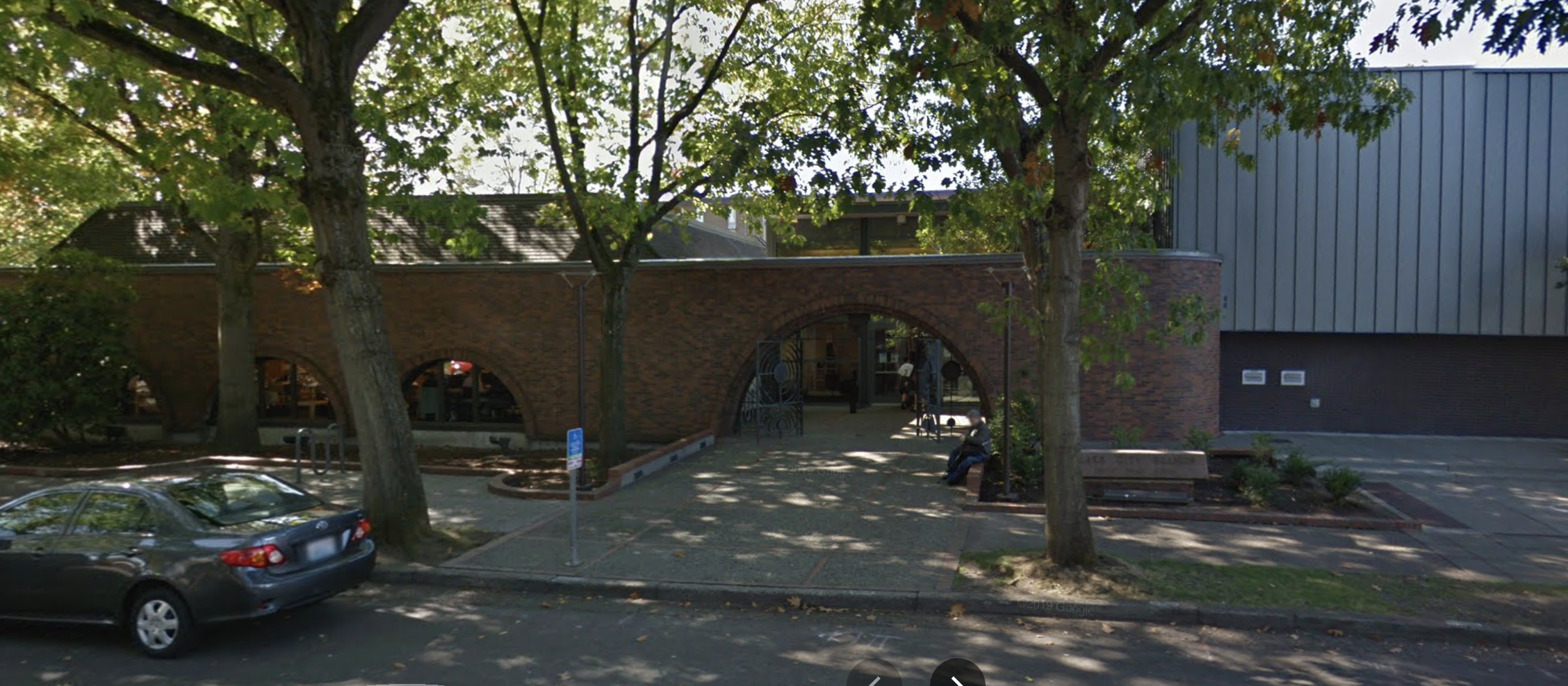
Lake City Library
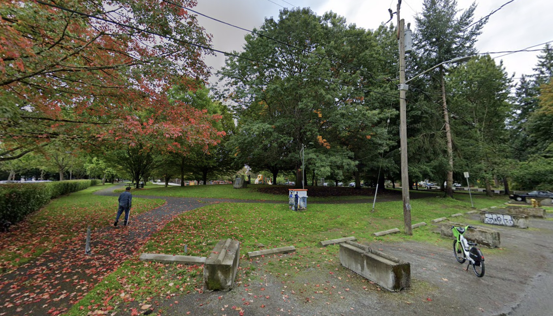
Virgil Park
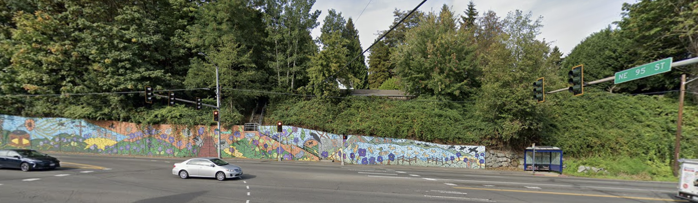
Lake City Mural
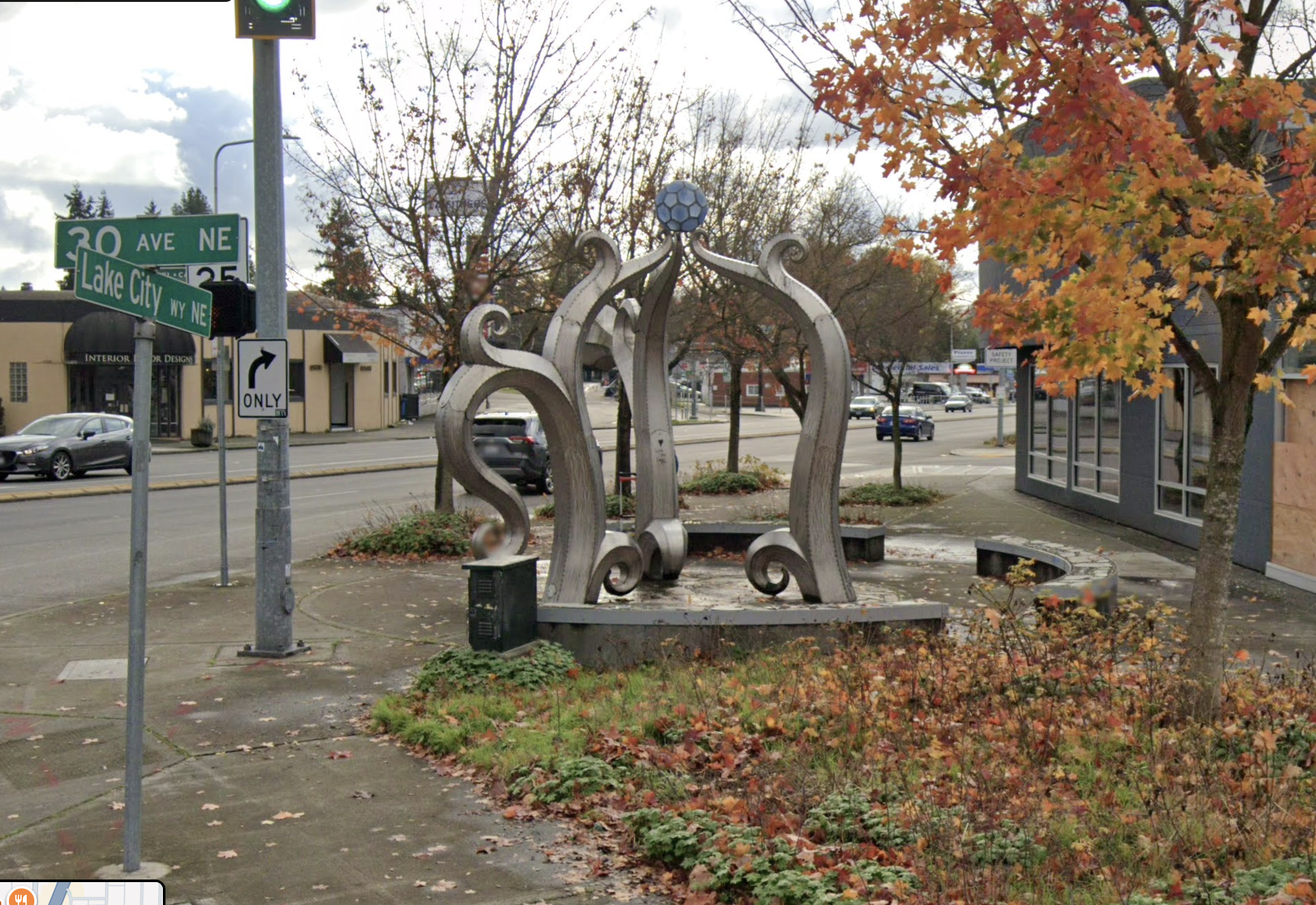
Coffee Pot Pergola
Privacy & Data Use
This site collects only what's needed to keep participation fair and meaningful.
Referenced Data & Methodology
Map Access Key
Walkability Data & Calculation: Walkability is calculated using actual walking routes from the RadiusMapper API with walking routes, which accounts for real street networks, sidewalks, and terrain. This analysis focuses on 15 and 10 minute walkable access, representing the actual distance a person can walk in those time frames along accessible routes. Walkability areas are simplified for smooth map interaction while maintaining accuracy.
Walkability Loss Analysis
To calculate what was lost, we compare access coverage before and after the closures using 15-minute walkable access polygons. All calculations use only the area within the Lake City boundary, so polygons extending outside Lake City are properly accounted for. Access percentages reflect area-based 15-minute walkable coverage of full-service resources that are broadly accessible to the public within the Lake City boundary and are not population-weighted.
Pharmacy Access Loss Calculation (37% loss):
- Before closures: We calculate the union of walkability polygons for ALL pharmacies (including those that later closed: Fred Meyer, Bartell Drugs, and Walgreens) excluding clinic-based pharmacies with limited availability (Seattle Indian Health Board and Genoa Healthcare). We then intersect this union with the Lake City boundary to get the area within Lake City. This gives us 55.9% of Lake City that had 15-minute walkable pharmacy access before closures.
- After closures: We calculate the union of walkability polygons for REMAINING OPEN pharmacies (excluding closed pharmacies and clinics). We intersect this union with the Lake City boundary. This gives us 19.0% of Lake City that has 15-minute walkable pharmacy access after closures.
- What was lost: We calculate the difference: 55.9% - 19.0% = 36.9% (rounded to 37%). This represents a loss of 37% of Lake City's pharmacy access due to the closure of Fred Meyer, Bartell Drugs, and Walgreens.
Supermarket Access Loss Calculation (22% loss from Fred Meyer):
- Before closures: We calculate the union of walkability polygons for ALL supermarkets (including Fred Meyer, which later closed). We intersect this union with the Lake City boundary. This gives us 40.7% of Lake City that had 15-minute walkable supermarket access before closures.
- After closures: We calculate the union of walkability polygons for REMAINING OPEN supermarkets only (QFC - North Seattle, QFC - Northgate, and Safeway). We intersect this union with the Lake City boundary. This gives us 18.8% of Lake City that has 15-minute walkable supermarket access after closures.
- What was lost: We calculate the difference: 40.7% - 18.8% = 21.9% (rounded to 22%). This represents a loss of 22% of Lake City's supermarket access due to Fred Meyer's closure.
Resource Selection Criteria:
These numbers reflect access to full-service supermarkets and full-service pharmacies only. When including clinic-based pharmacies with limited availability (Seattle Indian Health Board and Genoa Healthcare), pharmacy access dropped from 66.0% to 57.2% (a loss of 8.8% of Lake City's pharmacy access). However, these clinic-based pharmacies require enrollment, have limited hours, and may not meet neighborhood-scale demand.
Grocery coverage would appear higher if we included small grocers (such as Grocery Outlet), but this would be misleading because small grocers are not equivalent to large grocers or full-service supermarkets. Small grocers typically offer limited selection, fewer healthy options, variable fresh food availability, and often higher prices compared to full-service supermarkets. They cannot serve as anchor stores that meet neighborhood-scale grocery needs (see 2019 UW Food Availability Study).
Photo Credits
Lake City Library: Google Maps
Lake City Mural: Andrew Miller, Lake City Future First, Google Maps
Coffee Pot Pergola: Artist: Paul Sorey, Google Maps
Lake City Virgil Park: Google Maps
Closed Bartell Drugs: Google Maps
Closed Walgreens: The Seattle Times
Closed Fred Meyer: KOMO News
Group of people at fruit section: Morgan Von Gunten / Unsplash
Woman selects pineapple: ANYA RICHTER / Unsplash
Woman consults with pharmacist: National Cancer Institute / Unsplash
Pharmacy shelves: Franki Chamaki / Unsplash
Green leafy vegetables: Eduardo Soares / Unsplash
Four people holding each other: Vonecia Carswell / Unsplash
Empty store: Nathaniel Yeo / Unsplash